
Use of a LiDAR-derived landslide inventory map in assessing Influencing factors for landslide susceptibility of geological units in the Petrinja area (Croatia)
Article Sidebar
Main Article Content
Abstract
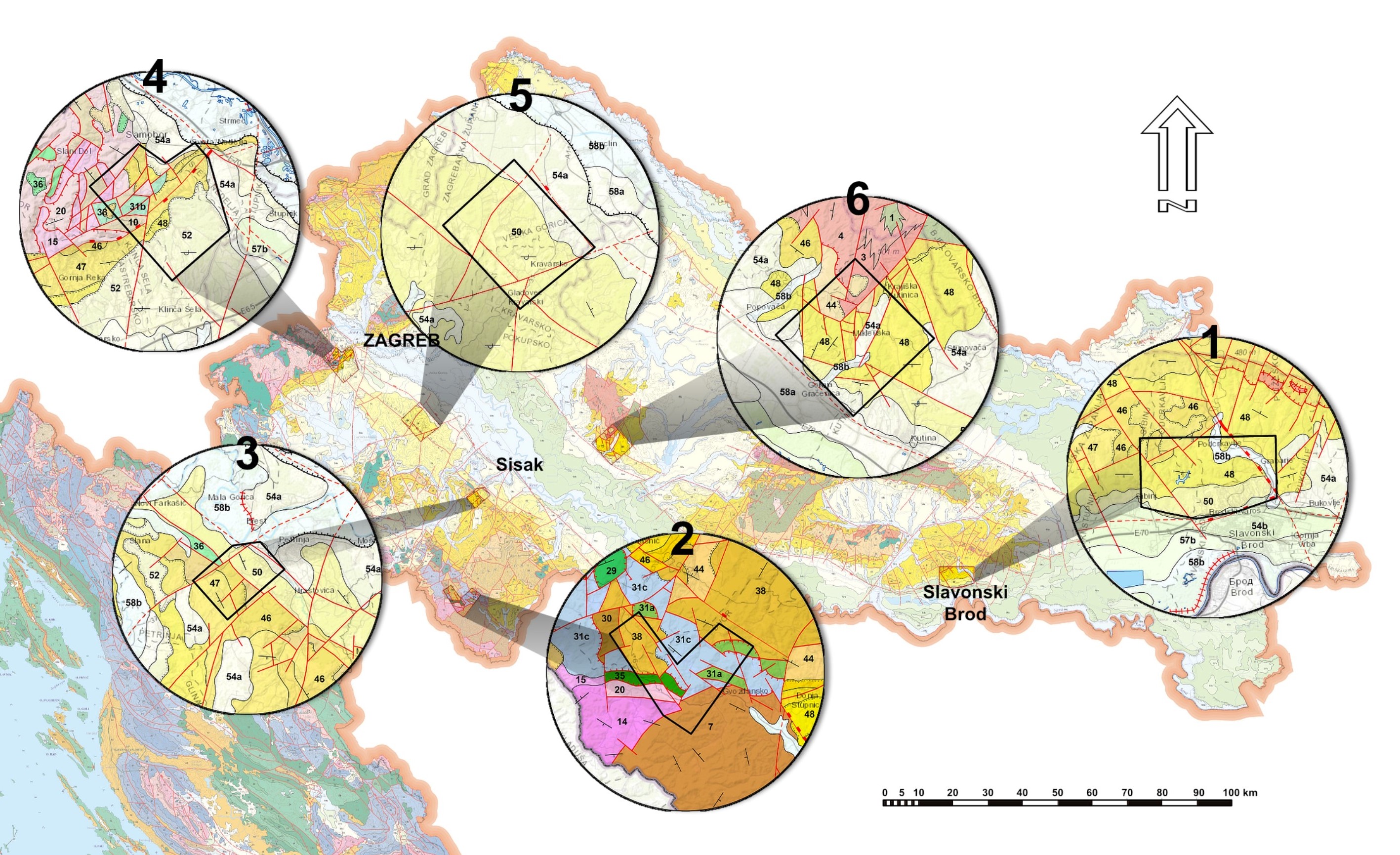
A landslide inventory was created for an area of 22.6 km2 near Petrinja city in northern Croatia, based on the high-resolution LiDAR data complemented by orthophoto maps. A total of 216 landslides were identified, covering 2.91 % of that area. Landslide polygons were overlain on geological units based on the Basic map of SFRY at a scale of 1:100,000 that is the largest scale geological map available for the whole of Croatia. The relationship between landslides and geological units was expressed as a landslide index. Three geological units displayed increased landslide susceptibility. A Pliocene unit clearly had the largest susceptibility, followed by a Palaeocene-Eocene unit, and finally a Badenian unit. Landslide density was analyzed within these geological units to identify influencing factors for landslide initiation. Each geological unit revealed different influencing factors. The Pliocene unit is mostly influenced by bedding plane orientation and local relief. Heterogeneousness lithology is the dominant factor in the Paleocene-Eocene unit, while the Badenian unit demonstrated the least certain interpretation as there are multiple factors involved. The forest road is presumed to be crucial, followed by spring occurrences and proximity to the tectonic boundary. The basic geological map of SFRY proved to be a viable source of geological information for the creation of landslide susceptibility maps at a scale of up to 1:100,000, but with limitations in the case of lithologically heterogeneous geological units. Larger scale maps require more detailed research as landslide susceptibility factors vary in each geological unit.
Article Details
Issue
Section
Authors have copyright and publishing rights on all published manuscripts.
References
ALEOTTI, P., & CHOWDHURY, R. (1999): Landslide hazard assessment: Summary review and new perspectives.– Bulletin of Engineering Geology and the Environment, 58/1, 21–44). doi: 10.1007/s100640050066
ALLABY, M. (2020): A Dictionary of geology and earth sciences.– Oxford University Press, 720 p. Available online on https://doi.org/10.1093/acref/9780198839033.001.0001 [Accesed on 11.07.2021.]
ALLMENDINGER, R. W., CARDOZO, N., & FISHER, D. M. (2012): Structural geology algorithms: Vectors and tensors.– Cambridge University Press, 289 p. doi: 10.1017/CBO9780511920202
ANBALAGAN, R. (1992): Landslide hazard evaluation and zonation mapping in mountainous terrain.– Engineering Geology, 32/4, 269–277. doi: 10.1016/0013-7952(92)90053-2
BARTELLETTI, C., GIANNECCHINI, R., D’AMATO AVANZI, G., GALANTI, Y., & MAZZALI, A. (2017): The influence of geological-morphological and land use settings on shallow landslides in the Pogliaschina T. Basin (northern apennines, Italy).– Journal of Maps, 13/2, 142–152. doi: 10.1080/17445647.2017.1279082
BELL, R., PETSCHKO, H., RÖHRS, M., & DIX, A. (2012): Assessment of landslide age, landslide persistence and human impact using airborne laser scanning digital terrain models.– Geografiska Annaler, Series A: Physical Geography, 94/1, 135–156. doi: 10.1111/j.1468-0459.2012.00454.x
BOOTH, A. M., ROERING, J. J., & PERRON, J. T. (2009): Automated landslide mapping using spectral analysis and high-resolution topographic data: Puget Sound lowlands, Washington, and Portland Hills, Oregon.– Geomorphology, 109/3–4, 132–147. doi: 10.1016/j.geomorph.2009.02.027
BUCCI, F., SANTANGELO, M., CARDINALI, M., FIORUCCI, F., & GUZZETTI, F. (2016): Landslide distribution and size in response to Quaternary fault activity: The Peloritani Range, NE Sicily, Italy.– Earth Surface Processes and Landforms, 41/5, 711–720. doi: 10.1002/esp.3898
CARDOZO, N., & ALLMENDINGER, R. W. (2013): Spherical projections with OSXStereonet.– Computers and Geosciences, 51, 193–205. doi: 10.1016/j.cageo.2012.07.021
CARRARA, A., CARDINALI, M., DETTI, R., GUZZETTI, F., PASQUI, V., & REICHENBACH, P. (1991): GIS techniques and statistical models in evaluating landslide hazard.– Earth Surface Processes and Landforms, 16/5, 427–445. doi: 10.1002/esp.3290160505
CASCINI, L. (2008): Applicability of landslide susceptibility and hazard zoning at different scales.– Engineering Geology, 102/3–4, 164–177. doi: 10.1016/j.enggeo.2008.03.016
CONFORTI, M., & IETTO, F. (2020): Influence of Tectonics and Morphometric Features on the Landslide Distribution: A Case Study from the Mesima Basin (Calabria, South Italy).– Journal of Earth Science, 31/2, 393–409. doi: 10.1007/s12583-019-1231-z
CRED, UNISDR (2018): Economic Losses, Poverty & Disasters 1998-2017. Available online at: https://www.preventionweb.net/files/61119_credeconomiclosses.pdf [Accesed on 13.07.2021.].
CRUDEN, D. M., & VARNES, D. J. (1996): Landslide types and processes.– Special Report, National Research Council, Transportation Research Board, 247, 36–75.
ČUBRILOVIĆ, P., PALAVESTRIĆ, L., NIKOLIĆ, T., & ĆIRIĆ, B. (1967): Inženjerskogeološka karta SFR Jugoslavije 1:500000 [Engineering geological map of SFR of Yugoslavia 1:500000 – in Croatian].– Savezni geološki zavod, Beograd.
DELLA SETA, M., DEL MONTE, M., FREDI, P., & LUPIA PALMIERI, E. (2004): Quantitative morphotectonic analysis as a tool for detecting deformation patterns in soft-rock terrains: a case study from the southern Marches, Italy.– Géomorphologie : Relief, Processus, Environnement, 10/4, 267–284. doi: 10.3406/morfo.2004.1224
EUROPEAN ENVIRONMENT AGENCY. (2010): Mapping the impacts of natural hazards and technological accidents in Europe.– European Environment Agency, 144 p , 13. doi: 10.2800/62638
FELL, R., COROMINAS, J., BONNARD, C., CASCINI, L., LEROI, E., & SAVAGE, W. Z. (2008): Guidelines for landslide susceptibility, hazard and risk zoning for land use planning.– Engineering Geology, 102/3–4, 85–98. doi: 10.1016/j.enggeo.2008.03.022
GETACHEW, N., & METEN, M. (2021): Weights of evidence modeling for landslide susceptibility mapping of Kabi-Gebro locality, Gundomeskel area, Central Ethiopia.– Geoenvironmental Disasters, 8, 6. doi: 10.1186/s40677-021-00177-z
GÖKCEOGLU, C., & AKSOY, H. (1996): Landslide susceptibility mapping of the slopes in the residual soils of the Mengen region (Turkey) by deterministic stability analyses and image processing techniques.– Engineering Geology, 44/1–4, 147–161. doi: 10.1016/s0013-7952(97)81260-4
GÖRÜM, T. (2019): Landslide recognition and mapping in a mixed forest environment from airborne LiDAR data.– Engineering Geology, 258, 105155. doi: 10.1016/j.enggeo.2019.105155
GUZZETTI, F., CARDINALI, M., REICHENBACH, P., & CARRARA, A. (2000): Comparing landslide maps: A case study in the upper Tiber River basin, central Italy.– Environmental Management, 25/3, 247–263. doi: 10.1007/s002679910020
GUZZETTI, FAUSTO, CARRARA, A., CARDINALI, M., & REICHENBACH, P. (1999): Landslide hazard evaluation: A review of current techniques and their application in a multi-scale study, Central Italy.– Geomorphology, 31/1–4, 181–216. doi: 10.1016/S0169-555X(99)00078-1
GUZZETTI, FAUSTO, MONDINI, A. C., CARDINALI, M., FIORUCCI, F., SANTANGELO, M., & CHANG, K. T. (2012): Landslide inventory maps: New tools for an old problem.– Earth-Science Reviews, 112/1–2, 42–66. doi: 10.1016/j.earscirev.2012.02.001
HAQUE, U., BLUM, P., DA SILVA, P.F., ANDERSEN, P., PILZ, J., CHALOV, S.R., MALET, J.-P., AUFLIČ, M.J., ANDRES, N., POYIADJI, E., LAMAS, P.C., ZHANG, W., PESHEVSKI, I., PÉTURSSON, T.K., DOBREV, N., GARCÍADAVALILLO, J.C., HALKIA, M., FERRI, S., GAPRINDASHVILI, G., ENGSTRÖM, J. & KEELLINGS, D. (2016): Fatal landslides in Europe.– Landslides, 13/6, 1545–1554. doi: 10.1007/s10346-016-0689-3
HERVÁS, J., & BOBROWSKY, P. (2009): Mapping: Inventories, susceptibility, hazard and risk.– In: Landslides - Disaster Risk Reduction.– Springer, Berlin, Heidelberg, 321–349. doi: 10.1007/978-3-540-69970-5_19
HORVÁTH, F., MUSITZ, B., BALÁZS, A., VÉGH, A., UHRIN, A., NÁDOR, A., KOROKNAI, B., PAP, N., TÓTH, T., & WÓRUM, G. (2015): Evolution of the Pannonian basin and its geothermal resources.– Geothermics, 53, 328–352. doi: 10.1016/j.geothermics.2014.07.009
JABOYEDOFF, M., OPPIKOFER, T., ABELLÁN, A., DERRON, M. H., LOYE, A., METZGER, R., & PEDRAZZINI, A. (2012): Use of LIDAR in landslide investigations: A review.– Natural Hazards, 61/1, 5–28. doi: 10.1007/s11069-010-9634-2
JURAK, V., MATKOVI, I., MIKLIN, Ž., & CVIJANOVIĆ, D. (1998): Landslide hazard in the Medvednica submountain area under dynamic conditions.– In: Marić, B., Lisac, Z. & Szavits-Nossan, A. (eds.): Geotechnical Hazards, XIth Danube - European conference on soil mechanics and geotechnical engineering.– Taylor & Francis, 827–834. doi: 10.1201/9781003078173-114
KAMB, W. B. (1959): Ice petrofabric observations from Blue Glacier, Washington, in relation to theory and experiment.– Journal of Geophysical Research, 64/11, 1891– 1909. doi: 10.1029/JZ064i011p01891
KLOSE, M., MAURISCHAT, P., & DAMM, B. (2015): Landslide impacts in Germany: A historical and socioeconomic perspective.– Landslides, 13/1, 183–199. doi: 10.1007/s10346-015-0643-9
KUREČIĆ, T. (2017): Sedimentologija i paleoekologija Pliocenskih Viviparus slojeva Vukomeričkih Gorica [Sedimentology and paleoecology of Pliocene Viviparus beds from the area of Vukomeričke Gorice – in Croatian].– Unpubl. PhD Thesis, Faculty of Science, University of Zagreb, 168 p.
KUREČIĆ, T., KOVAČIĆ, M., & GRIZELJ, A. (2021): Mineral assemblage and provenance of the Pliocene Viviparus beds from the area of Vukomeričke Gorice (Central Croatia).– Geologia Croatica, 74/3, 253-271. doi: 10.4154/gc.2021.16
MALAMUD, B. D., TURCOTTE, D. L., GUZZETTI, F., & REICHENBACH, P. (2004): Landslide inventories and their statistical properties.– Earth Surface Processes and Landforms, 29/6, 687–711. doi: 10.1002/esp.1064
MALLET, C., & BRETAR, F. (2009): Full-waveform topographic lidar: State-of-theart.– ISPRS Journal of Photogrammetry and Remote Sensing, 64/1, 1–16. doi: 10.1016/j.isprsjprs.2008.09.007
MANDIC, O., KUREČIĆ, T., NEUBAUER, T. A., & HARZHAUSER, M. (2015): Stratigraphic and palaeogeographic significance of lacustrine molluscs from the pliocene viviparus beds in Central Croatia.– Geologia Croatica, 68/3, 179–207. doi: 10.4154/gc.2015.15
MARKUŠIĆ, S., STANKO, D., PENAVA, D., IVANČIĆ, I., BJELOTOMIĆ ORŠULIĆ, O., KORBAR, T., & SARHOSIS, V. (2021): Destructive M6.2 Petrinja Earthquake (Croatia) in 2020–Preliminary Multidisciplinary Research.– Remote Sensing, 13/6, 1095. doi: 10.3390/rs13061095
MCCALPIN, J. (1984): Preliminary age classification of landslides for inventory mapping.– Proceedings of the Annual Symposium on Engineering Geology and Soil Engineering, 21, Moscow, Idaho, 99–120.
MOLIN, P., FUBELLI, G., & DRAMIS, F. (2012): Evidence of tectonic influence on drainage evolution in an uplifting area: The case of Northern Sila (Calabria, Italy).– Geografia Fisica e Dinamica Quaternaria, 35/1, 49–60. doi: 10.4461/GFDQ.2012.35.5
NEUMAYR, M., & PAUL, C. M. (1875): Die Congerien- und Paludinenschichten Slavoniens und deren Faunen : ein Beitrag zur Descendenz-Theorie / von M. Neumayr und C.M. Paul.– Hölder, 164 p. doi: 10.5962/bhl.title.14331
PAVELIĆ, D., & KOVAČIĆ, M. (2018): Sedimentology and stratigraphy of the Neogene rift-type North Croatian Basin (Pannonian Basin System, Croatia): A review.– Marine and Petroleum Geology, 91, 455–469. doi: 10.1016/j.marpetgeo.2018.01.026
PAWLUSZEK, K. (2019): Landslide features identification and morphology investigation using high-resolution DEM derivatives.– Natural Hazards, 96/1, 311–330. doi: 10.1007/s11069-018-3543-1
PETSCHKO, H., BELL, R., & GLADE, T. (2016): Effectiveness of visually analyzing LiDAR DTM derivatives for earth and debris slide inventory mapping for statistical susceptibility modeling.– Landslides, 13/5, 857–872. doi: 10.1007/s10346-015-0622-1
PIKIJA, M. (1983): Geološka i strukturna obrada područja Petrinja-Hrastovica-Slana.– Unpubl. report, Geološki zavod, Zagreb, 26 p.
PIKIJA, M. (1987a): Osnovna geološka karta SFRJ 1:100000, list Sisak L33−93 [Basic Geological Map of SFRY 1:100000, Sisak sheet L33-93 – in Croatian].– Geološki zavod, Zagreb, Savezni geološki institut, Beograd.
PIKIJA, M. (1987b): Osnovna geološka karta SFRJ 1:100.000, Tumač za list Sisak L33–93 [Basic Geological Map of SFRY 1:100000, Geology of the Sisak sheet L33-93 – in Croatian].– Geološki zavod, Zagreb, Savezni geološki institut, Beograd.
POLLAK, D., GULAM, V., NOVOSEL, T., AVANIĆ, R., TOMLJENOVIĆ, B., HEĆEJ, N., TERZIĆ, J., STIPČEVIĆ, J., BAČIĆ, M., KUREČIĆ, T., DOLIĆ, M., BOSTJANČIĆ, I., WACHA, L., KOSOVIĆ, I., BUDIĆ, M., VUKOVSKI, M., BELIĆ, N., ŠPELIĆ, M., BRČIĆ, V., BARBAČA,J., KORDIĆ, B., PALENIK, D., FILJAK, R., FRANGEN, T., PAVIĆ, M., URUMOVIĆ, K., SEČANJ, M., MATOŠ, B., GOVORČIN, M., KOVAČEVIĆ, M.S. & LIBRIĆ, L. (2021): The preliminary inventory of coseismic ground failures related to December 2020 – January 2021 Petrinja earthquake series.– Geologia Croatica, 74/2, 189–208. doi: 10.4154/gc.2021.08
RAZAK, K. A., STRAATSMA, M. W., VAN WESTEN, C. J., MALET, J. P., & DE JONG, S. M. (2011): Airborne laser scanning of forested landslides characterization: Terrain model quality and visualization.– Geomorphology, 126/1–2, 186–200. doi: 10.1016/j.geomorph.2010.11.003
REICHENBACH, P., ROSSI, M., MALAMUD, B. D., MIHIR, M., & GUZZETTI, F. (2018): A review of statistically-based landslide susceptibility models.– Earth- Science Reviews, 180, 60–91. doi: 10.1016/j.earscirev.2018.03.001
RUNDIĆ, L., VASIĆ, N., ŽIVOTIĆ, D., BECHTEL, A., KNEŽEVIĆ, S., & CVETKOV, V. (2016): The Pliocene Paludina lake of Pannonian Basin: New evidence from northern Serbia.– Annales Societatis Geologorum Poloniae, 86/2, 185–209. doi: 10.14241/asgp.2016.003
SAFTIĆ, B., VELIĆ, J., SZTANÓ, O., JUHÁSZ, G., & IVKOVIĆ, Ž. (2003): Tertiary subsurface facies, source rocks and hydrocarbon reservoirs in the SW part of the Pannonian Basin (Northern Croatia and south-western Hungary).– Geologia Croatica, 56/1, 101–122. doi:10.4154/232
SALEEM, N., ENAMUL HUQ, M., TWUMASI, N. Y. D., JAVED, A., & SAJJAD, A. (2019): Parameters derived from and/or used with digital elevation models (DEMs) for landslide susceptibility mapping and landslide risk assessment: A review.– ISPRS International Journal of Geo-Information, 8/12, 545. doi: 10.3390/ijgi8120545
SCHULZ, W. H. (2007): Landslide susceptibility revealed by LIDAR imagery and historical records, Seattle, Washington.– Engineering Geology, 89/1–2, 67–87. doi: 10.1016/j.enggeo.2006.09.019
SCHULZ, W.H. (2004): Landslides mapped using LIDAR imagery, Seattle, Washington.U.S.– Geological Survey Open–File Report 2004–1396, 11 p.
ŠESTANOVIĆ, S. (2001): Osnove geologije i petrografije [Fundamentals of geology and petrography – in Croatian].– Sveučilište u Splitu, Građevinski fakultet, 234 p.
SLATTON, K. C., CARTER, W. E., SHRESTHA, R. L., & DIETRICH, W. (2007): Airborne Laser Swath Mapping: Achieving the resolution and accuracy required for geosurficial research.– Geophysical Research Letters, 34/23, 1–5. doi: 10.1029/2007GL031939
TOBLER, W. (1987): Measuring Spatial Resolution.– In: Proceedings of the Land Resources Information Systems Conference, Beijing, China, 25–29 October 1987, pp. 12–16.
VAN DEN EECKHAUT, M., & HERVÁS, J. (2012): State of the art of national landslide databases in Europe and their potential for assessing landslide susceptibility, hazard and risk.– Geomorphology, 139–140, 545–558. doi: 10.1016/j.geomorph.2011.12.006
VAN WESTEN, C. J., CASTELLANOS, E., & KURIAKOSE, S. L. (2008): Spatial data for landslide susceptibility, hazard, and vulnerability assessment: An overview.– Engineering Geology, 102/3–4, 112–131. doi: 10.1016/j.enggeo.2008.03.010
WIECZOREK, G. F. (1983): Preparing a Detailed Landslide-Inventory Map for Hazard Evaluation and Reduction.– Bulletin of the Association of Engineering Geologists, 21/3, 337–342. doi: 10.2113/gseegeosci.xxi.3.337
ZANINOVIĆ, K., GAJIĆ-ČAPKA, M., PERČEC TADIĆ, M., VUČETIĆ, M., MILKOVIĆ, J., BAJIĆ, A., CINDRIĆ, K., CVITAN, L., KATUŠIN, Z., KAUČIĆ, D., LIKSO, T., LONČAR, E., LONČAR, Ž., MIHAJLOVIĆ, D., PANDŽIĆ, K., PATARČIĆ, M., SRNEC, L. & VUČETIĆ, V. (2008): Klimatski atlas Hrvatske: 1961-1990, 1971-2000 [Climate atlas of Croatia: 1961-1990, 1971-2000 – in Croatian].– Državni hidrometeorološki zavod, Zagreb, 200 p.
ZHOU, S., CHEN, G., FANG, L., & NIE, Y. (2016): GIS-based integration of subjective and objective weighting methods for regional landslides susceptibility mapping.– Sustainability, 8/4, 334. doi: 10.3390/su8040334