In Press
Vol. 79 No. 2 (2026)
Vol. 79 No. 1 (2026)
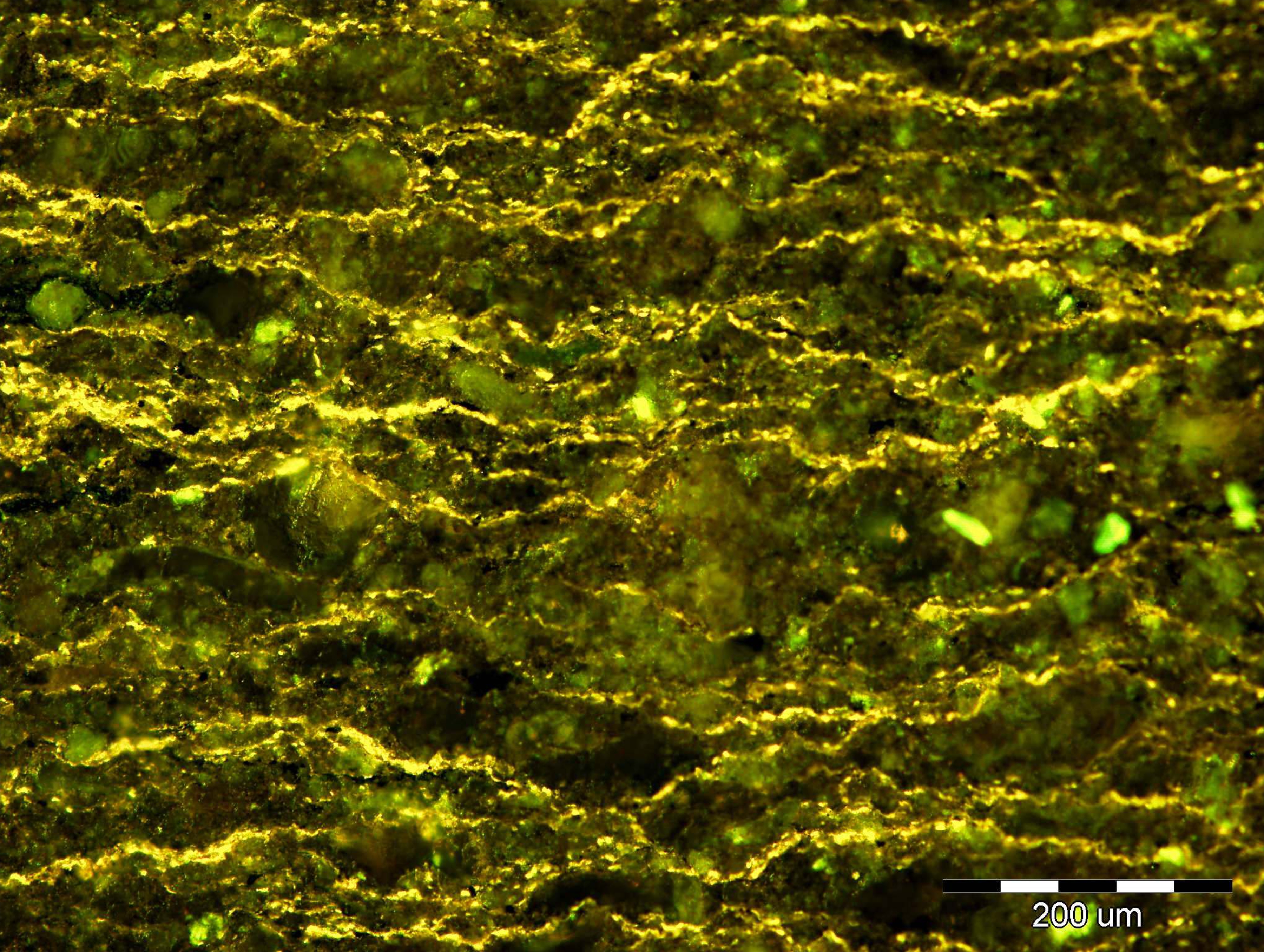
Photomicrograph of organic matter from Jurassic carbonates and shales, Lemeš Trough, Poštak Mt. Lamalginite (whole rock, perpendicular to bedding, blue-fluorescent light). For more information see the paper by TROSKOT-ČORBIĆ & TAKAČ (this Vol.).
Vol. 78 No. 3 (2025)
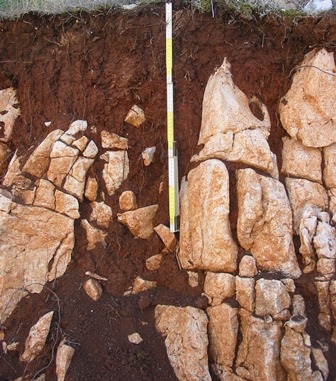
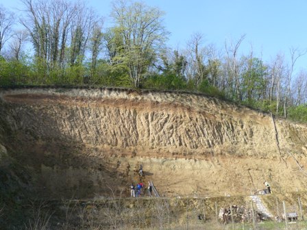
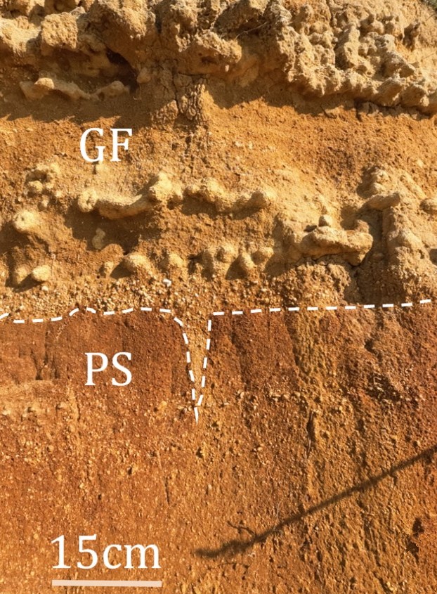
The pedo-sedimentary complex of Privlaka (Croatia): erosion boundary between palaeosol (PS) and glacio-fluvial deposits (GF), characterised by carbonate concretions. For more information see the paper by RUŽIČIĆ et al. (this Vol.).

Vol. 78 No. 2 (2025)
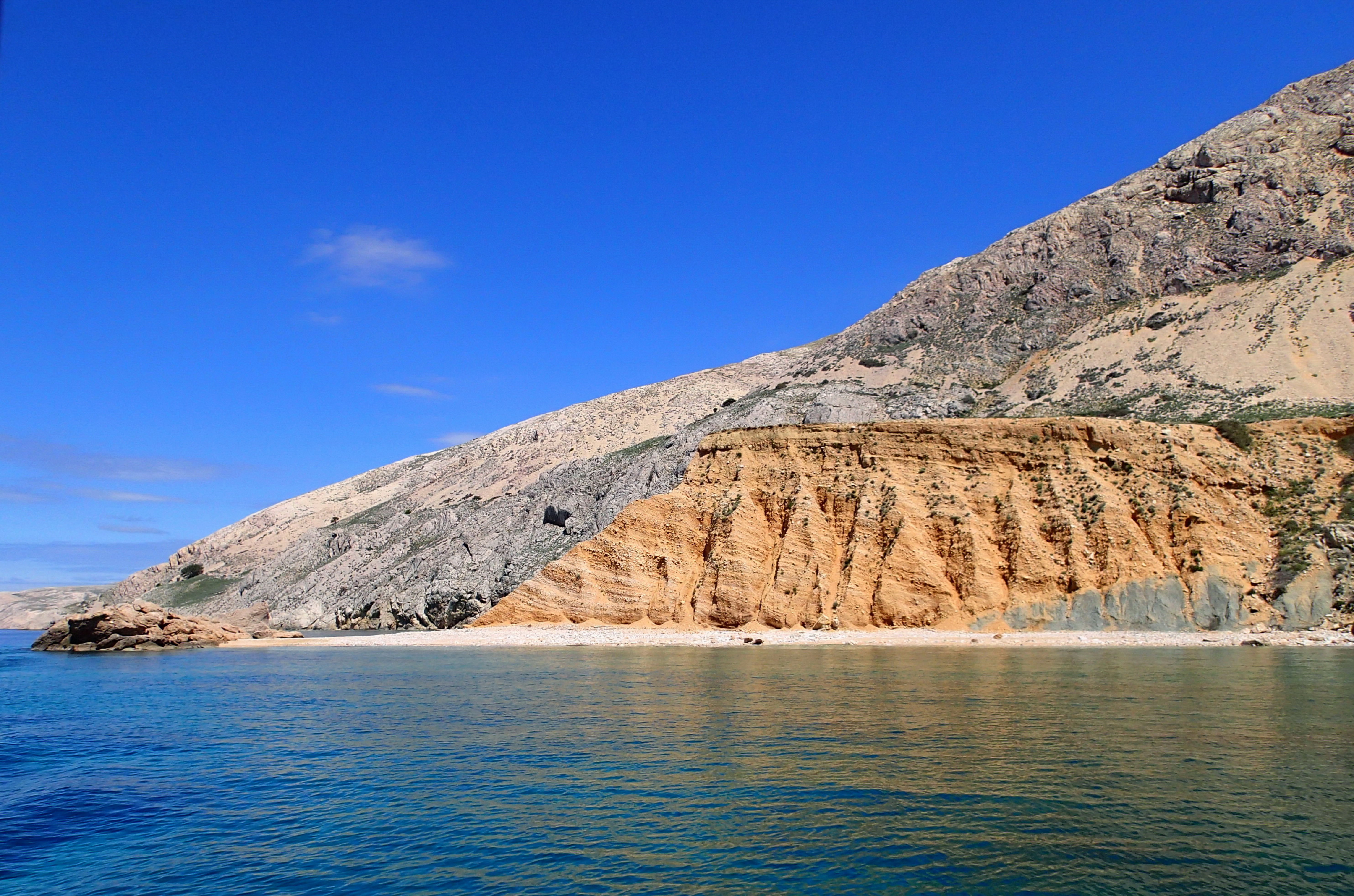
Lithology model developed using predicted volume of shale values derived from standardized input data in the eastern part of Drava Basin. For more information see the paper by KAMENSKI et al. (this Vol.)

Vol. 78 No. 1 (2025)
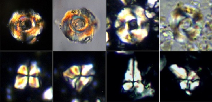
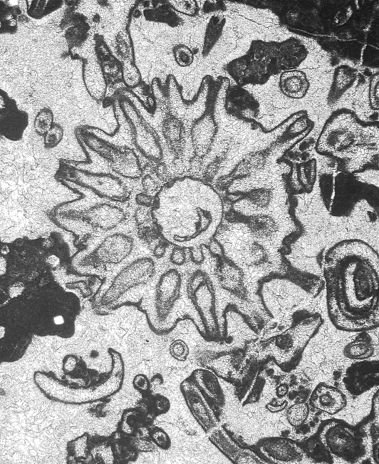
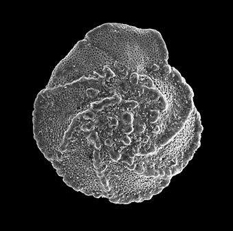
Orbiculiformella radiata DE WEVER from the Early Jurassic radiolarian fauna collected in the Weitenau area in the central Northern Calcareous Alps (Austria). For more information see the paper by CIFER et al. (this Vol.).
Vol. 77 No. 3 (2024)
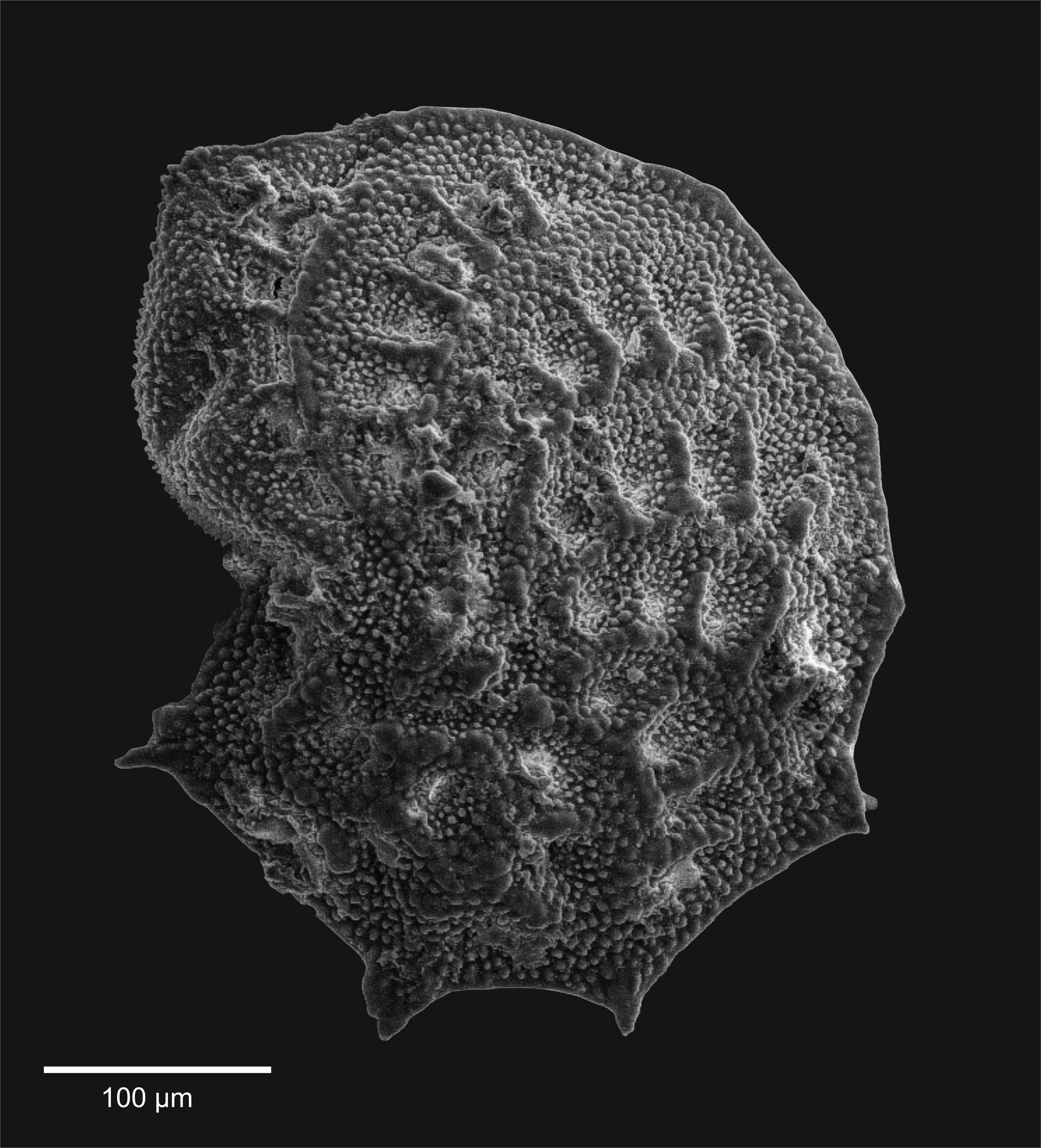
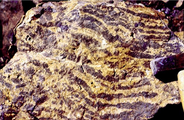
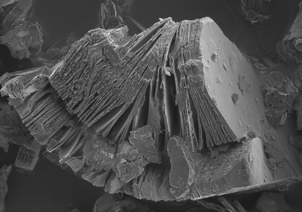
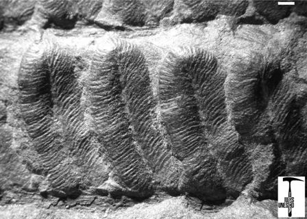
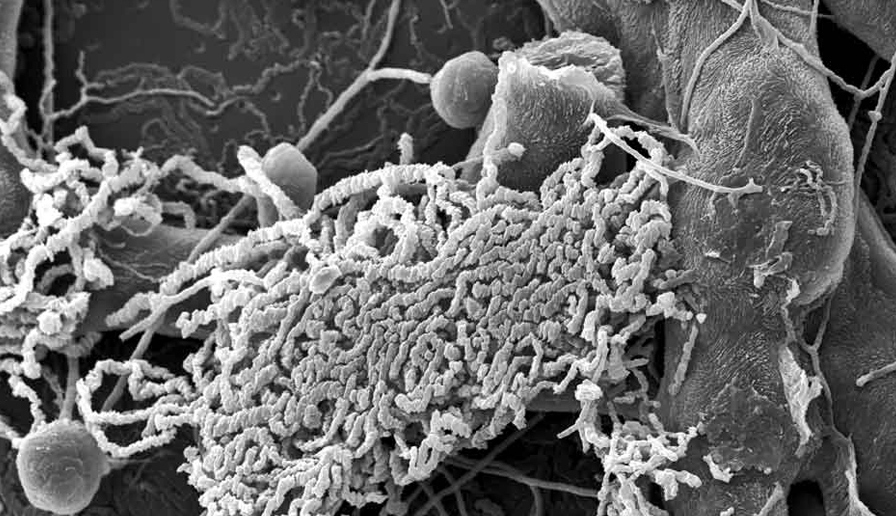
Microboring traces from the aphotic deep sea zone: Scolecia serrata RADTKE, 1991. For more information see the paper by GOLUBIC et al. (this Vol.).
Vol. 77 No. 2 (2024)
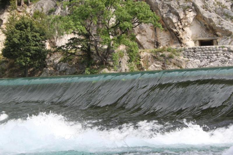
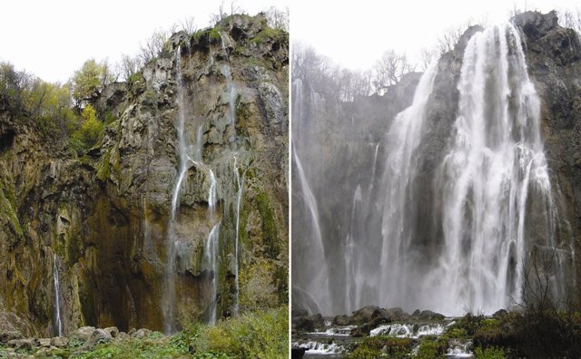
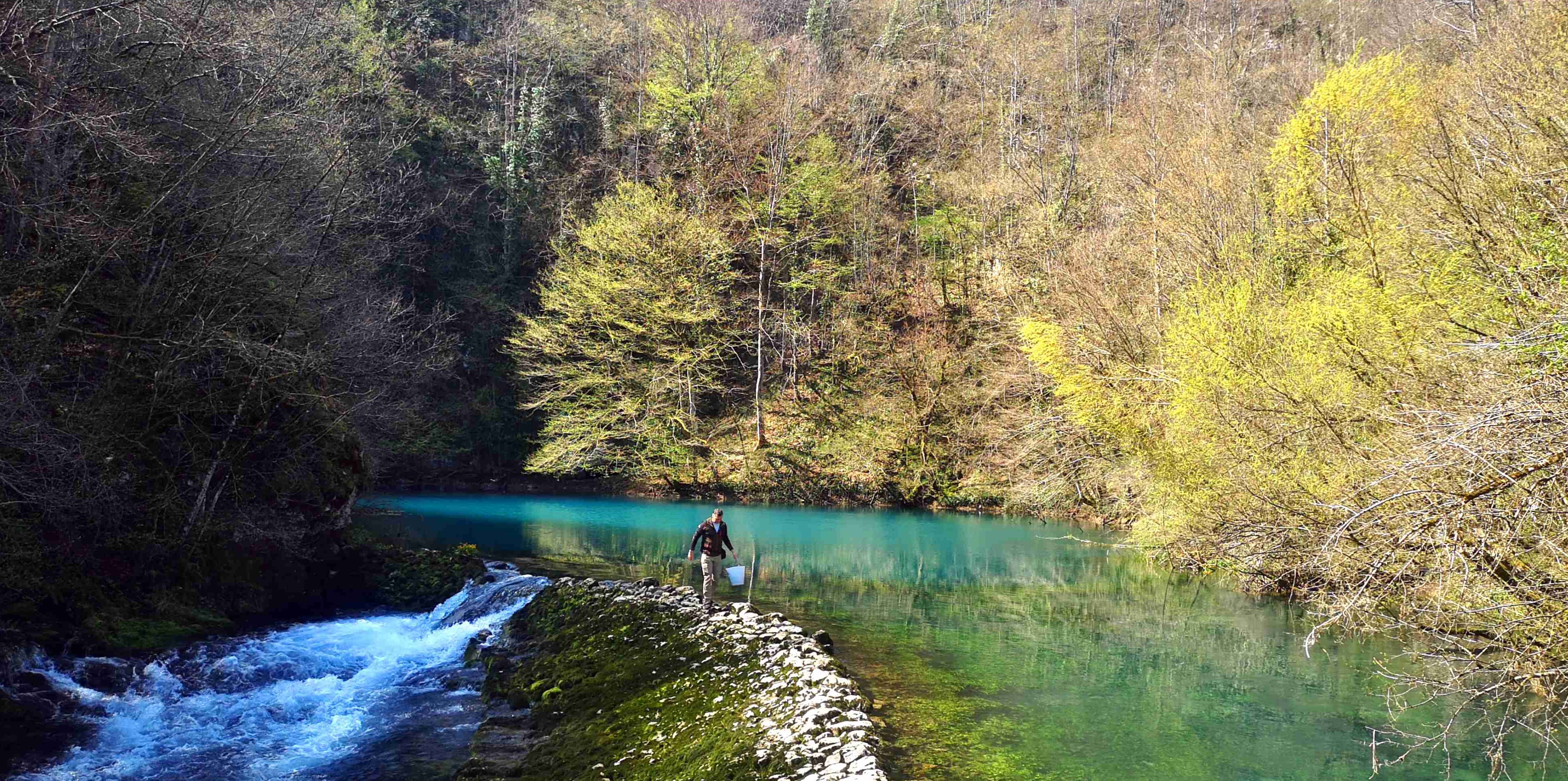
The Slunjčica spring during low water conditions. For more information see the paper BOLJAT et al. (this Vol.).

Vol. 77 No. 1 (2024)
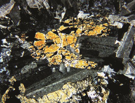
Photomicrograph of violet dumortierite from Mt. Moslavačka Gora, occurring in form of parallel fibrous and acicular crystals in a mineral assemblage with pleochroic light to deep brown biotite and feldspar which is strongly altered to dark brown clay minerals. For more information see the paper GARAŠIĆ et al. (this Vol.).

Vol. 76 No. 3 (2023)
Gravitational collapse structure on Liburnian coast (Rijeka Bay). For more information see the paper BENAC et al. (this Vol.).
Vol. 76 No. 2 (2023)
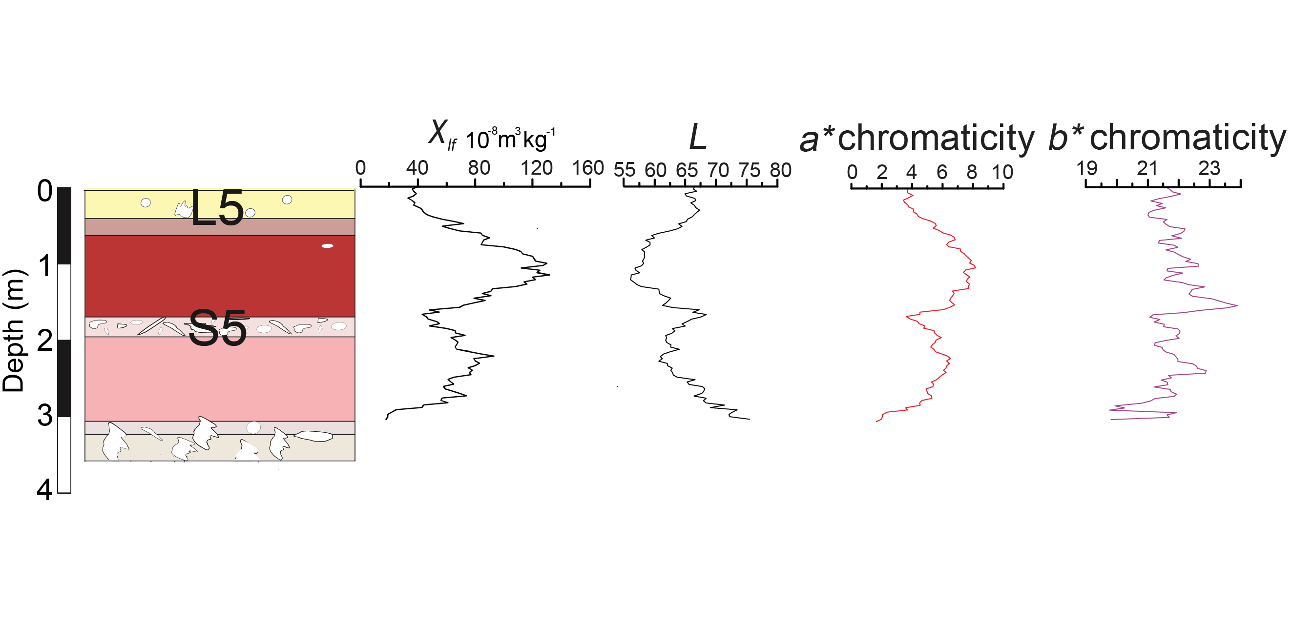
Calculated colorimetric parameters and indices for Dukatar Loess Palaeosol Sequence (LPS) pedocomplex. For more information see the paper LUKIĆ et al. (this Vol.).
Vol. 76 No. 1 (2023)
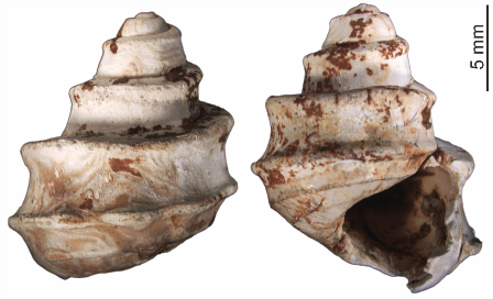
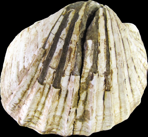
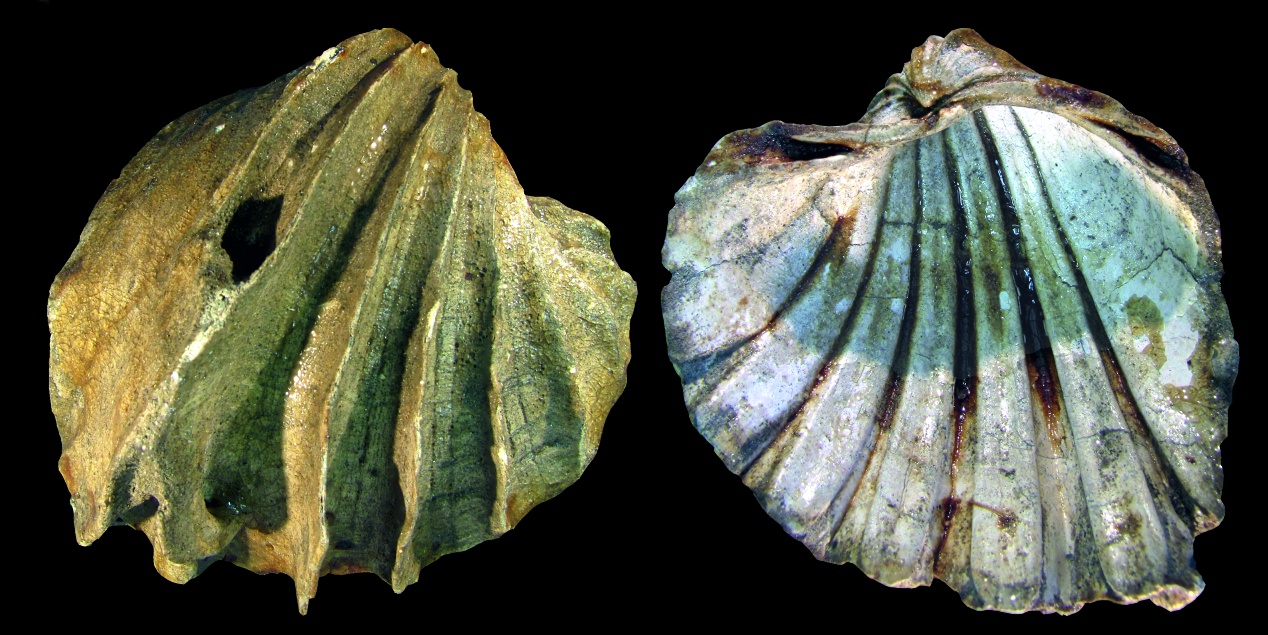
Cover: Lake Pannon cockle Lymnocardium (Budmania) ferrugineum (BRUSINA, 1874) from the Zagreb–Okrugljak locality. It lived in the littoral zone of the Late Miocene Lake Pannon on sandy substratum. For more information see the paper by MAGYAR & KATONA (this Vol.).
Vol. 75 No. 3 (2022)
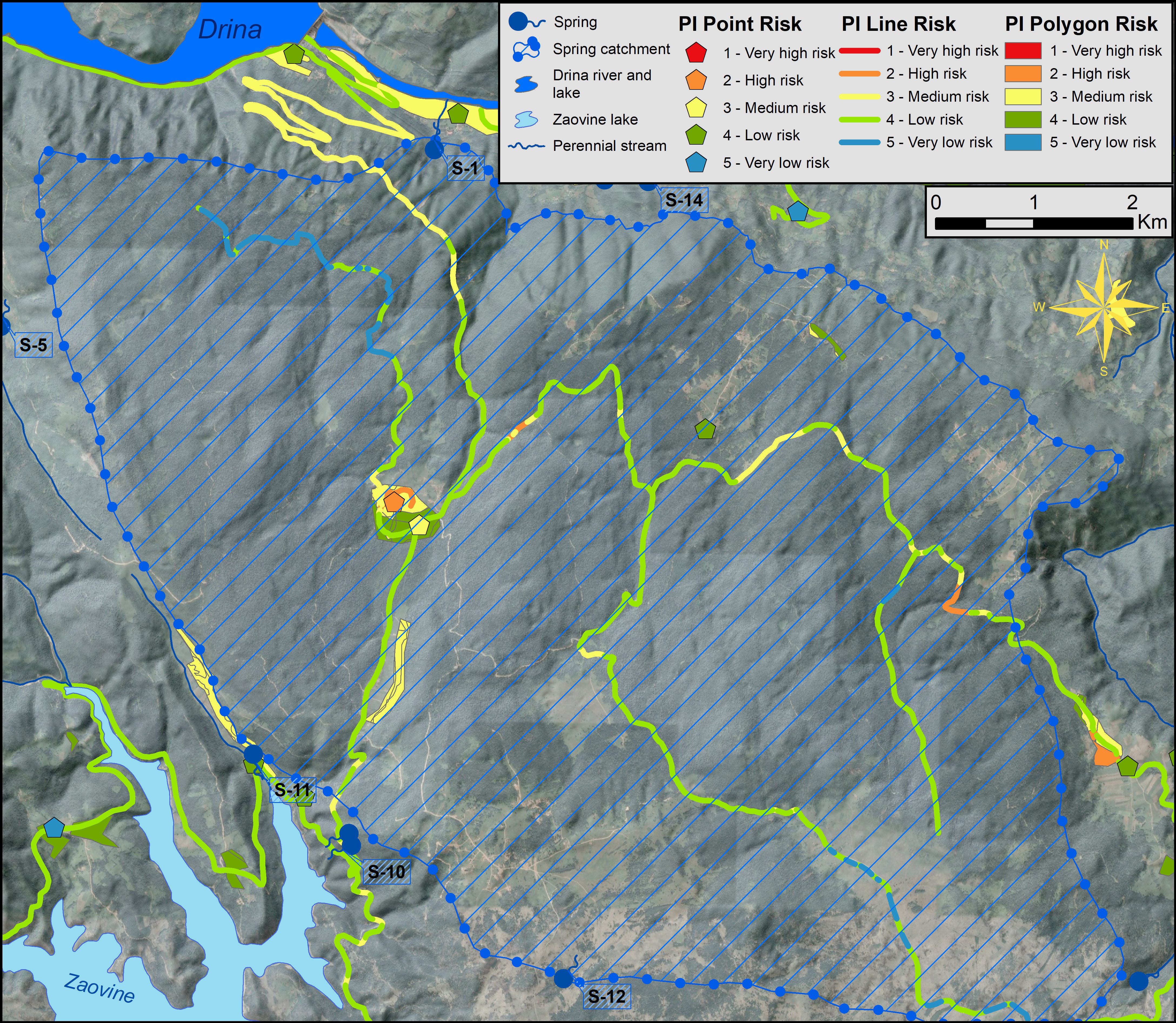
This figure shows the groundwater contamination risk map of the Perućac spring catchment area located in the National Park Tara (Eastern Serbia). The risk map was obtained using a PI groundwater vulnerability map and a map of existing hazards in the catchment area – for more information, see the paper by Živanović et al. (this Vol.)
Special Issue
Vol. 75 (2022)
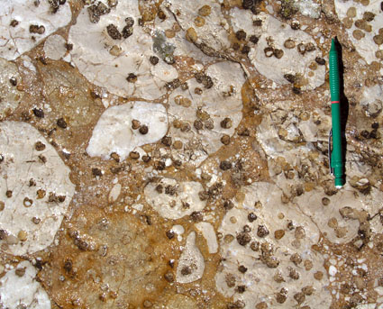
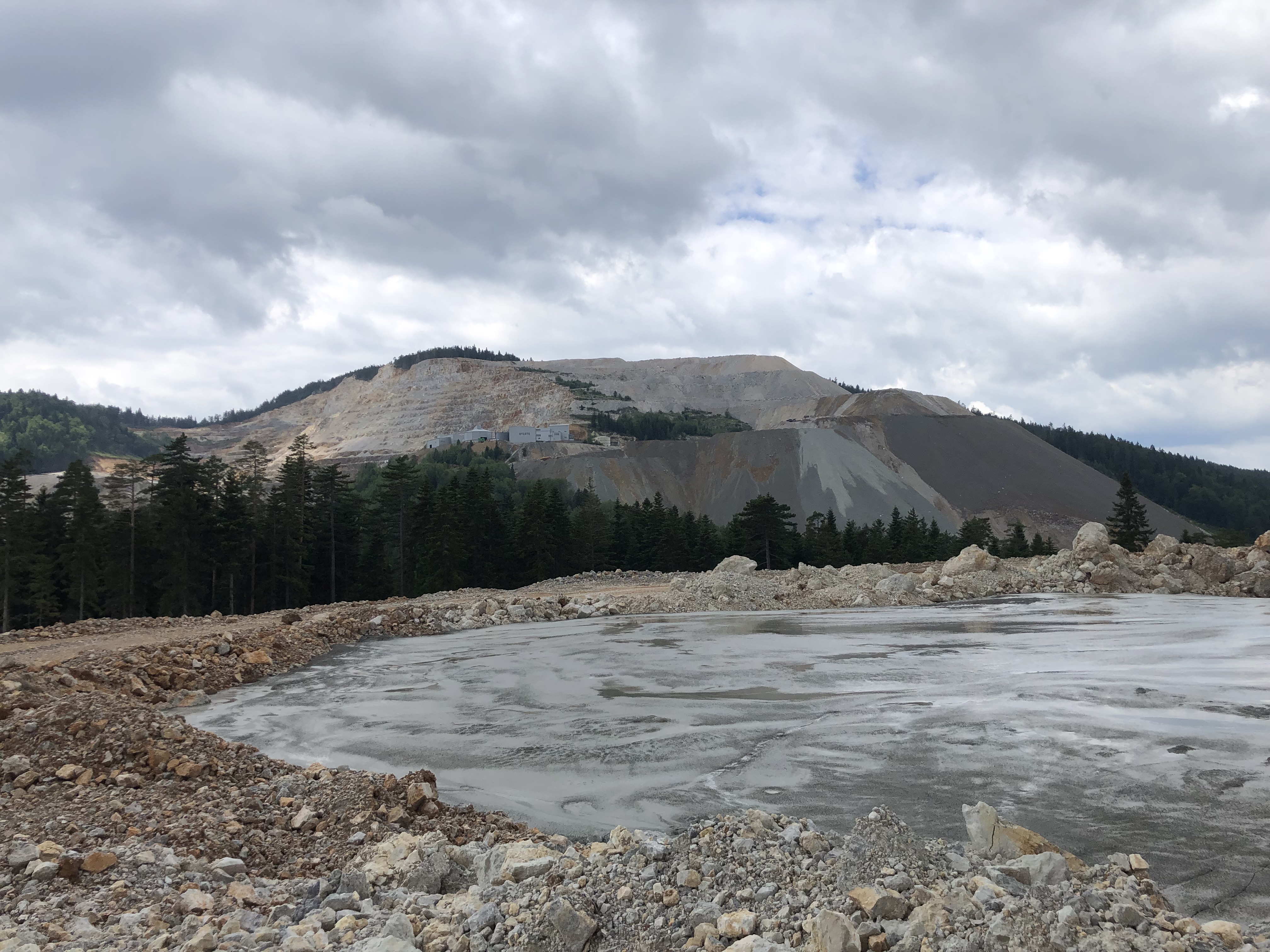
The lead and zinc mine at “Šuplja stijena”, Pljevlja. Open pit, waste rock dump and flotation tailings – for more information see the paper by Radusinović et al. (this Vol.)

Vol. 75 No. 2 (2022)
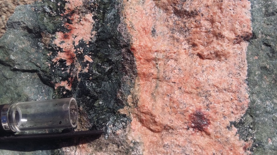
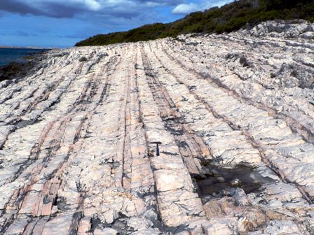
Columnar jointing of albite rhyolite, UNESCO geosite Rupnica, Mt. Papuk, northern Croatia – for more information see the paper by Schneider et al. (this Vol.)
Vol. 75 No. 1 (2022)
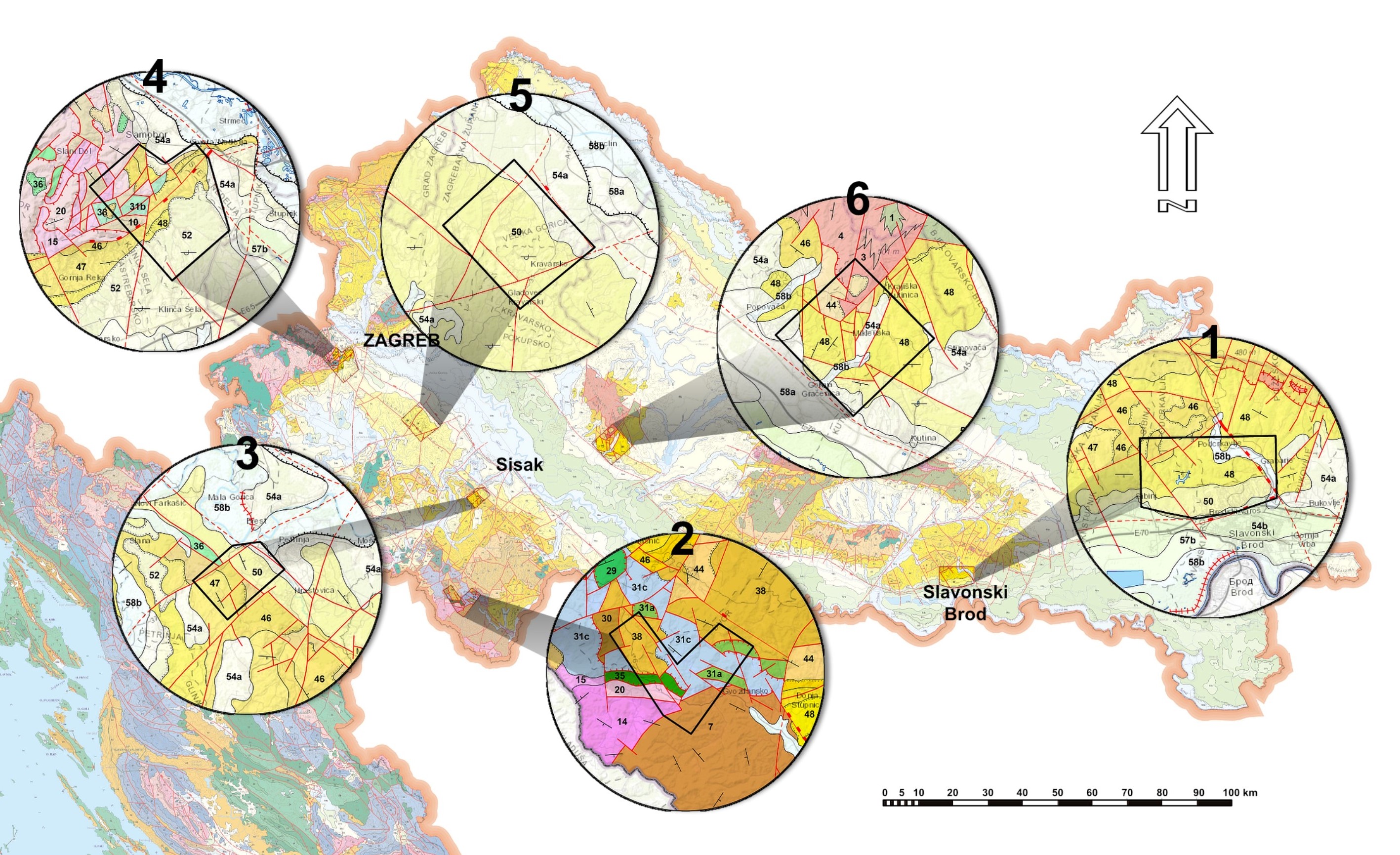
Spatial distribution of the study polygons on the geological map of the Republic of Croatia M 1: 300.000 (HGI, 2009) – for more information see the papers by BOSTJANČIĆ et al. – polygon 1, FILIPOVIĆ et al. – polygon 2, FRANGEN et al. – polygon 3, GULAM et al. – polygon 4, PODOLSZKI et al. – polygon 5 and POLLAK et al. – polygon 6 (this Vol.)

Vol. 74 No. 3 (2021)
This figure shows vertical, perpendicular, and horizontal slicing crosssections of the CT data set of the BCF/ 4L2 core sample. The dry intersected sliced image (on the left)visualizes the CT HU variations accompanied by their spatial porosity distributions on the right. The underneath mapped sliced scales clarify the HU values and the voxel porosity percentages, respectively. The textural pattern of the Convolution deformed structure has been conserved in the CT porosity scan image; red arrows trace the convolute lamination in both scan image slices. For more information see the paper Abutaha, Geiger & Gulyás (this Vol.)

Vol. 74 No. 2 (2021)
The biggest dropout doline formed after the earthquake series in the Petrinja area, Croatia. Picture taken by Tihomir Frangen. For more information see the paper Pollak et al. (this Vol.)
Vol. 74 No. 1 (2021)
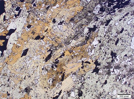
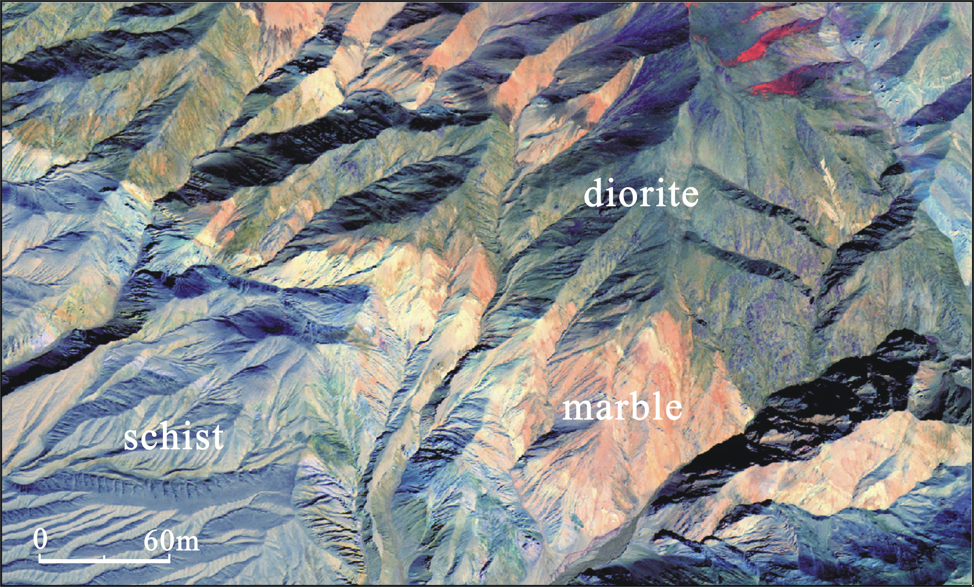
Tashkurgan Region, West Kunlun, China. A combination of band8, band4/band1, and band5/band3 from the WorldView–2 data facilitated identification of diorite, marble, and schist, or highlight the different lithological differences and improve the accuracy of lithological interpretations. For more information see the paper Fan et al. (pg. 57, this Vol.)

Vol. 73 No. 3 (2020)
Correlation of the upper Miocene – Pliocene lithostratigraphic units in Croatia and Hungary along the axis of the Drava Basin, with the preferred formation names capitalized. Age limits of the formations come from biostratigraphy. For more information see the paper Sebe et al. (this Vol.)

Vol. 73 No. 2 (2020)
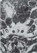
Thin section photomicrograph of planktonic foraminifera Globotruncanita stuarti from Maastrichtian pelagic limestones on the island of Svetac (central Adriatic, Croatia). Scale bar 0.2 mm. Photo by L. Fuček – for more information see the paper Korbar et al. (this Vol.)
Vol. 73 No. 1 (2020)
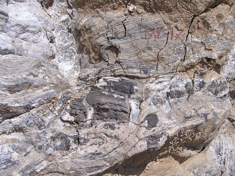
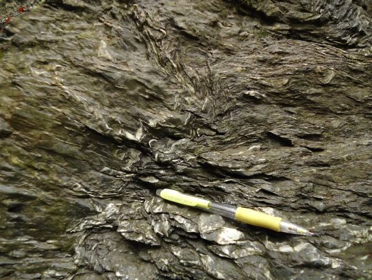
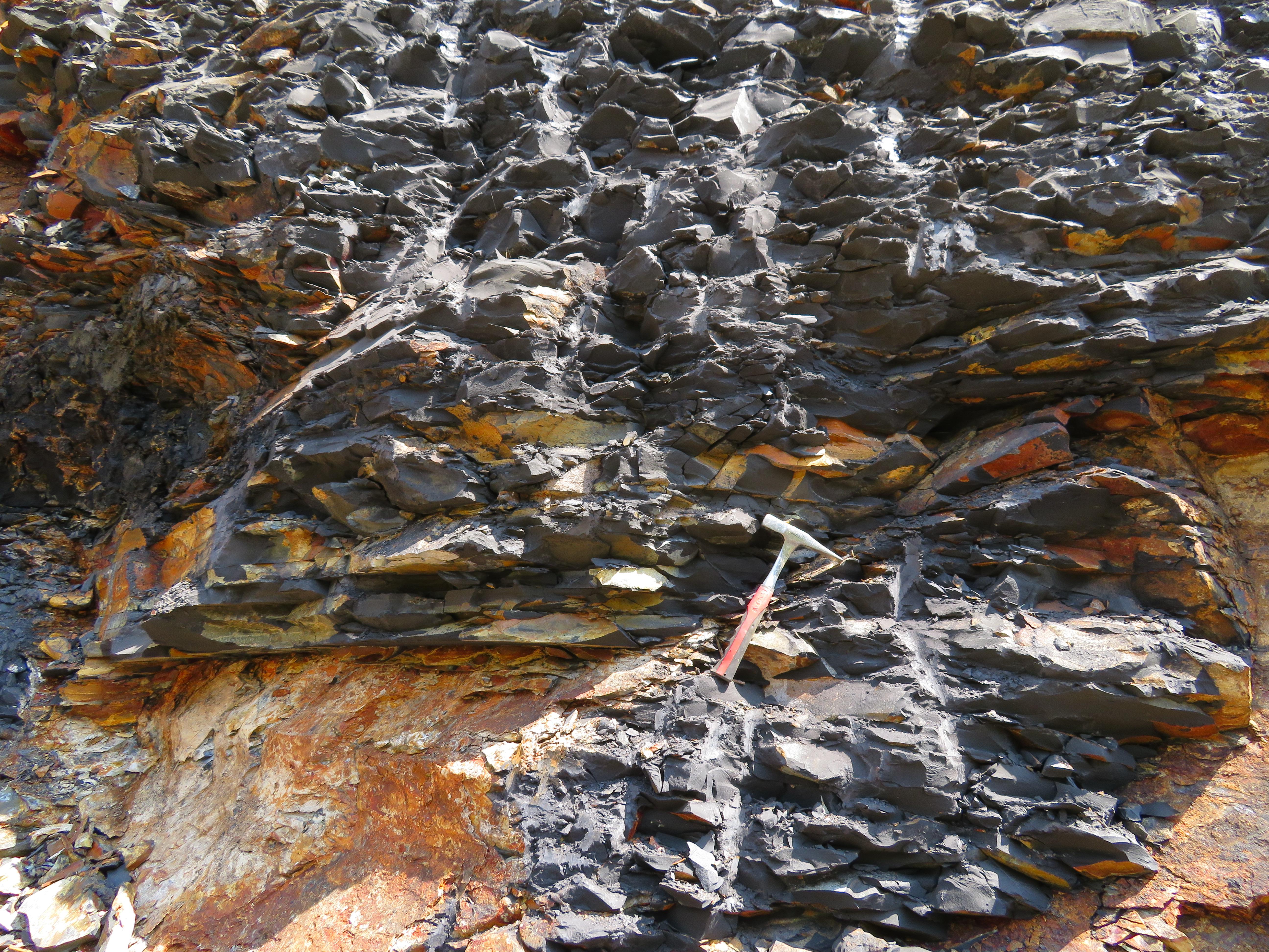
The Niutitang Formation is mainly composed of black carbonaceous shale, silty shale, and black carbonaceous siliceous shale with siltstone and marl. The shale and siltstone form very fine horizontal bedding - for more information see the paper by Xie et al. (this Vol.)

Special issue
Vol. 72 (2019)
Vol. 72 No. 3 (2019)
The tombolo, southwestern coast of Prvić Island, Kvarner area, north eastern Adriatic Sea (photo: Čedomir Benac) – for more information see the paper by Benac et al. (this Vol.)

Vol. 72 No. 2 (2019)
The final part of Lake Pannon infill (Late Miocene, Beli Potok trough) consists of gray silts and sandy marls (lower part) and brownish to gray, sandy marls and silts (middle part). It contains fossil molluscs and ostracods which indicate to “Upper Pontian” (sensu Stevanović). Above this, there is a light yellow layer of sandy silt (up to 2 m thick), which contains carbonate concretions of different sizes. Finally, the Quaternary yellowish to brown proluvial-deluvial deposits up to 1m thick covers the section.