
The use of high-resolution LiDAR scanning in the research of small landslides based on Croatian examples
Article Sidebar
Main Article Content
Article Details
Issue
Section
Authors have copyright and publishing rights on all published manuscripts.
References
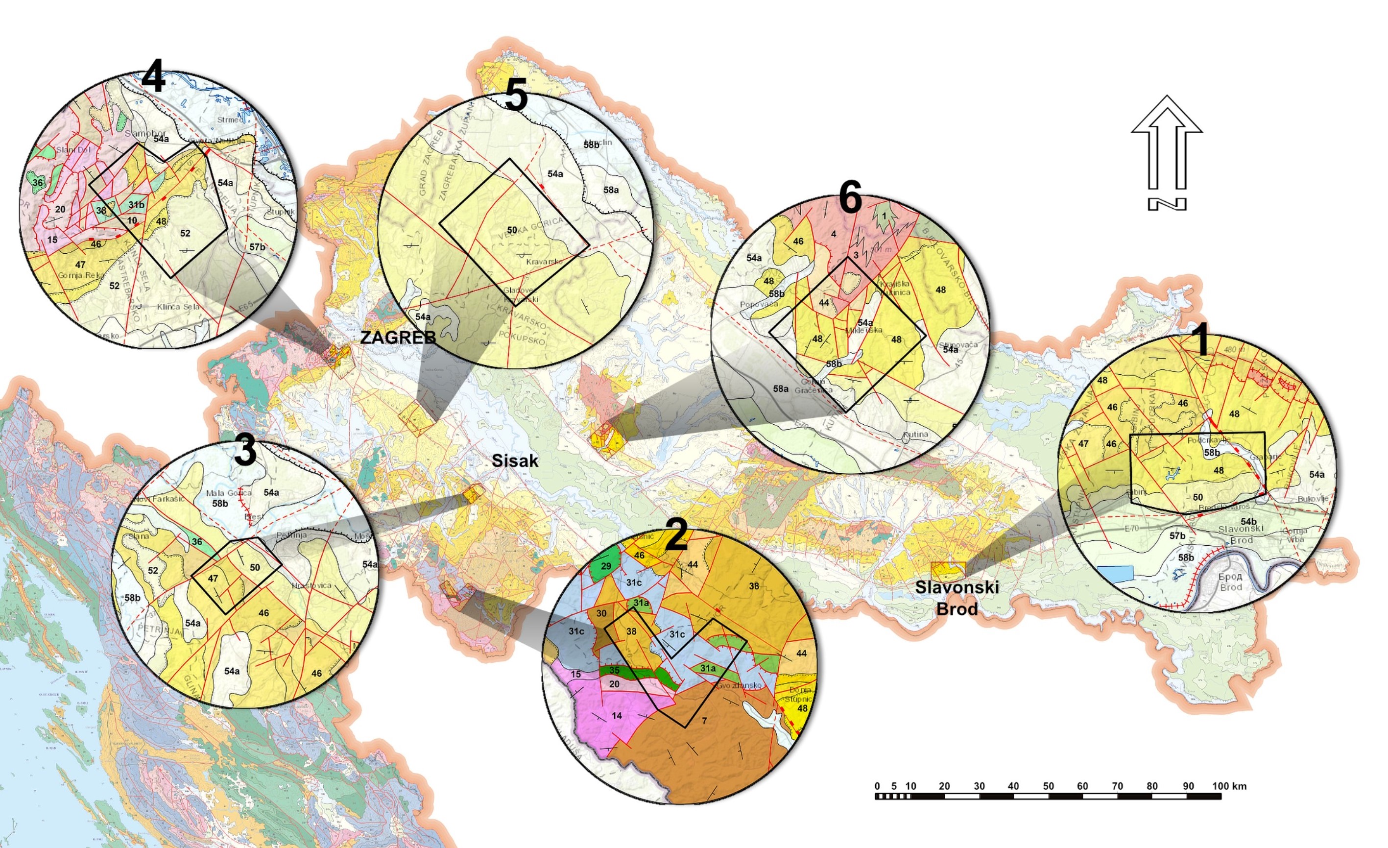
BOSTJANČIĆ, I., AVANIĆ, R., FRANGEN, T. & PAVIĆ, M. (2022): Spatial distribution and geometric characteristics of landslides with special reference to geological units in the area of Slavonski Brod, Croatia. doi: 10.4154/gc.2022.03
COROMINAS, J., VAN WESTEN, C., FRATTINI, P., CASCINI, L., MALET, J.-P., FOTOPOULOU, S., CATANI, F., VAN DEN EECKHAUT, M., MAVROULI, O., AGLIARDI, F., PITILAKIS, K., WINTER, M.G., PASTOR, M., FERLISI, S., TOFANI, V., HERVA´S, J. & SMITH, J.T. (2014): Recommendations for the quantitative analysis of landslide risk. Bulletin of Engineering Geology and the Environment, 73, 209–263. Doi: 10.1007/s10064-013-0538-8
FELL, R., COROMINAS, J., BONNARD, C., CASCINI, L., LEROI, E. & SAVAGE, W.Z. (2008): Guidelines for landslide susceptibility, hazard and risk zoning for land use planning.– Engineering geology, 102/3–4, 85–98. doi: 10.1016/j.enggeo.2008.03.022
FILIPOVIĆ, M., MIŠUR, I., GULAM, V. & HORVAT, M. (2022): A case study in the research polygon in Glina and Dvor municipality, Croatia–landslide susceptibility assessment of geological units. doi: 10.4154/gc.2022.04
FRANGEN, T., PAVIĆ, M., GULAM, V. & KUREČIĆ, T. (2022): Use of LiDAR-derived landslide inventory map in assessing Influencing factors for landslide susceptibility of geological units in the Petrinja area (Croatia). doi: 10.4154/gc.2022.10
GULAM, V., BOSTJANČIĆ, I., HEĆEJ, N., FILIPOVIĆ, M. & FILJAK, R. (2022): Preliminary analysis of LiDAR-based landslide inventory in the area of Samobor, Croatia. Doi: 10.4154/gc.2022.11
PODOLSZKI, L., KUREČIĆ, T., BATESON, L. & SVENNEVIG, K. (2022): Remote landslide mapping, field validation and model development – An example from Kravarsko, Croatia. doi: 10.4154/gc.2022.01
POLLAK, D., HEĆEJ, N. & GRIZELJ, A. (2022): Landslide inventory and characteristics, based on LiDAR scanning and optimised field investigations in the Kutina area, Croatia. doi: 10.4154/gc.2022.02
VARNES, D.J. & IAEG (1984): Landslide Hazard Zonation: A Review of Principles and Practice. UNESCO, Paris, 63 p.