
Landslide inventory and characteristics, based on LiDAR scanning and optimised field investigations in the Kutina area, Croatia
Article Sidebar
Main Article Content
Abstract
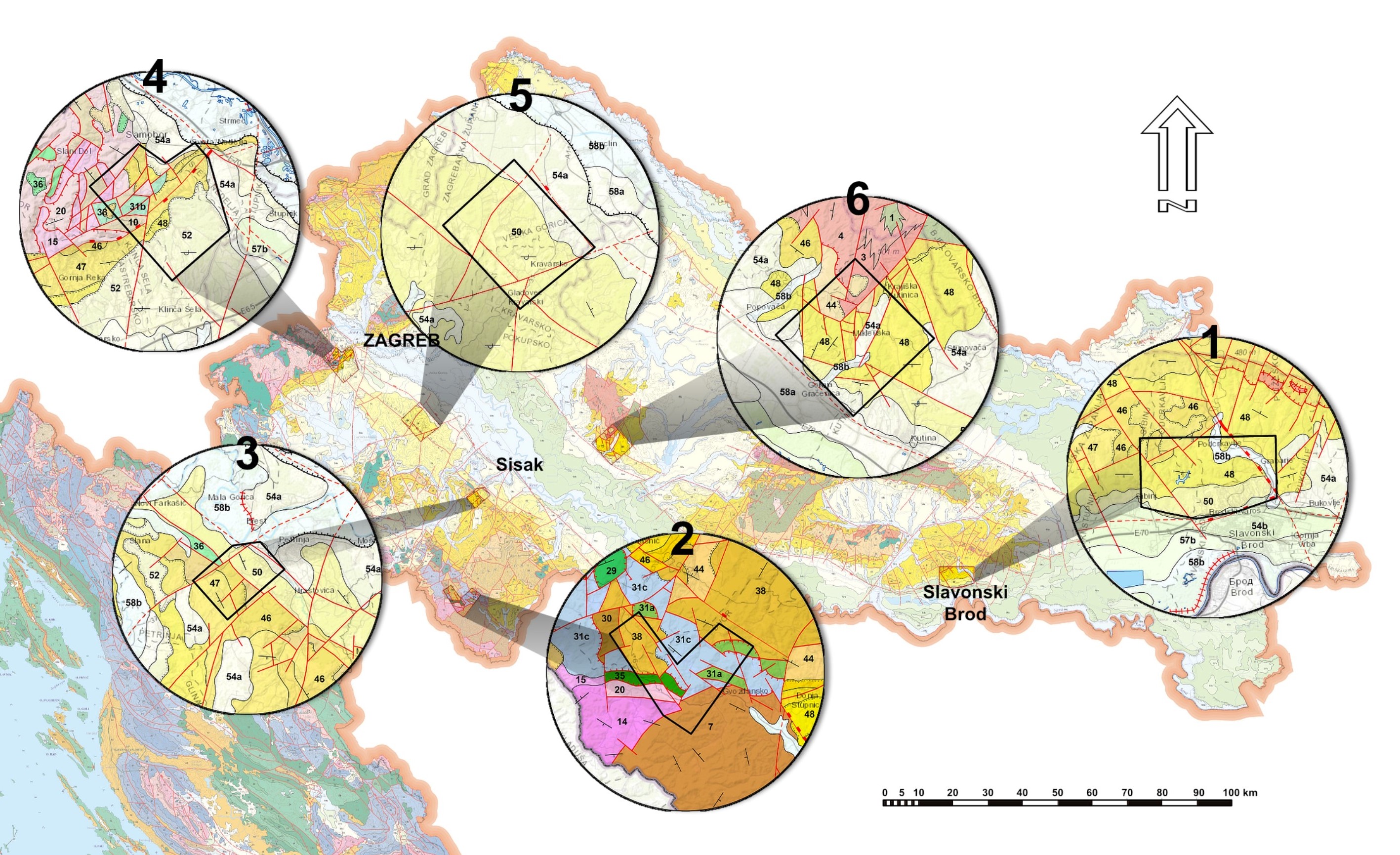
This paper presents the preliminary results of analyses of landsliding processes derived from detailed LiDAR (Light Detection and Ranging) scans supported by field prospection on the south-western slopes of Mt. Moslavačka gora, in the wider Kutina area. This area is known for frequent landslides, but dedicated regional landslide research has not been previously undertaken.
High resolution LiDAR scanning and orthophoto imaging enabled the production of a reliable landslide inventory, but also enabled research on landslide properties and the morphology of the area. Field mapping and prospection, sampling and borehole coring assisted in the collection of information about the material characteristics and specific features of typical landslides. In the research area, which covers more than 71 km2, more than 1200 very small landslides were detected. The majority of landslides were discovered in just several geological units indicating their high susceptibility: Pleistocene silts and sands with clayey interlayers, followed by M2 silty sands and gravels, and M7 sands. Nearly half of the landslides are estimated to be of recent and younger age, while other landslides may be considered as being historical implying a “long tradition” of landslide events in the research area. Preliminary terrain surface roughness analysis also supported the conclusion that the inventory contains landslides of several historical generations which are still detectable. In addition to slides (1123), this research also discovered numerous earthflow processes (143), which are more frequent in the predominantly sandy units.
The landslides in this area are largely located on the banks of the gullies and are directly related to the action of water. Regarding that situation and the engineering properties of the encountered geological units, four types of bank instabilities can be differentiated: slides on top of rock masses; slides in firm soil mixtures; landslides in sands; landslides in predominantly coherent soil complexes.
Article Details
Issue
Section
Authors have copyright and publishing rights on all published manuscripts.
References
BELL, R., PETSCHKO, H., RÖHRS, M. & DIX, A. (2012): Assessment of landslide age, landslide persistence and human impact using airborne laser scanning digital terrain models.- Geografiska Annaler: Series A, Physical Geography, 94/1, 135-156. doi: 10.1111/j.1468-0459.2012.00454.x
BERTI, M., CORSINI, A. & DAEHNE, A. (2013): Comparative analysis of surface roughness algorithms for the identification of active landslides.– Geomorphology, 182, 1-18. doi: 10.1016/j.geomorph.2012.10.022
ĆORIĆ, S., PAVELIĆ, D., RÖGL, F., MANDIC, O., VRABAC, S., AVANIĆ, R., JERKOVIĆ, L. & VRANJKOVIĆ, A. (2009): Revised Middle Miocene datum for initial marine flooding of North Croatian Basins (Pannonian Basin System, Central Paratethys).– Geol. Croat. 62/1, 31–43. doi.org/10.4154/GC.2009.03
CRNKO, J. (2014): Osnovna geološka karta Republike Hrvatske 1:100.000, List Kutina, [Basic Geological Map of Republic of Croatia, 1:100000. Kutina sheet – in Croatian]. Hrvatski geološki institut, Zagreb.
CRNKO, J., VRAGOVIĆ, M. (2014): Osnovna geološka karta Republike Hrvatske 1:100000, Tumač za list Kutina, [Basic Geological Map of Republic of Croatia, 1:100000, Geology of the Kutina sheet – in Croatian].– Hrvatski geološki institut, Zagreb, 75 p.
CRUDEN, D.M. & VARNES, D.J. (1996): Landslide types and processes.- In: TURNER, A. K. & SCHUSTER, R. L. (eds): Landslides investigation and mitigation. Transportation Research Board, US National Research Council, TRB, Special Report, 247, 36-75. http://onlinepubs.trb.org/Onlinepubs/sr/sr247/sr247-003.pdf
ČUBRILOVIĆ, P., PALAVESTRIĆ, LJ., NIKOLIĆ, T. (1967): Inženjersko geološka karta SFR Jugoslavije 1:500000 Engineering-Geological Map of SFR of Yugoslavia Scale 1:500 000 – in Croatian].– Institute for geological and geophysical research - Belgrade.
FANOS, A.M., PRADHAN, B. (2018): Laser Scanning Systems and Techniques in Rockfall Source Identification and Risk Assessment: A Critical Review.– Earth Systems and Environment 2, 163–182. doi: 10.1007/s41748-018-0046-x
FELL, R. (1994): Landslide risk assessment and acceptable risk.- Canadian Geotechnical Journal, 31, 261-272. doi: 10.1139/t94-031
GARRISS, R. N. (2019): Modeling Surface Roughness as an Indicator of Age and Landslide Susceptibility, and the Spatial Inventory of Prehistoric Landslides: Green River Valley, Washington.– Portland State University, Dissertations and Theses, Paper 5175, 79. doi: 10.15760/etd.7051
GÖRÜM, T. (2019): Landslide recognition and mapping in a mixed forest environment from airborne LiDAR data.– Engineering Geology, 258, 1-17. doi: 10.1016/j.enggeo.2019.105155
GRIZELJ, A., PEH, Z., TIBLJAŠ, D., KOVAČIĆ, M., KUREČIĆ, T. (2017): Mineralogical and geochemical characteristics of Miocene pelitic sedimentary rocks from the south-western part of the Pannonian Basin System (Croatia): Implications for provenance studies.– Geosci. Front. 8 /1; 65-80. doi:10.1016/j.gsf.2015.11.009
GROHMANN, C. H., SMITH, M. J. & RICCOMINI, C. (2011): Multi-scale Analysis of Topographic Surface Roughness in the Midland Valley, Scotland.– IEEE Transactions on Geoscience and Remote Sensing, 49, 1200-1213. doi:10.1109/TGRS.2010.2053546
GUZZETTI, F., MONDINI, A. C., CARDINALI, M., FIORUCCI, F., SANTANGELO, M., CHANG K. T. (2012) Landslide inventory maps: new tools for an old problem.- Earth-Science Reviews, 112/1–2, 42–66. doi: 10.1016/j.earscirev.2012.02.001
HARZHAUSER, M & PILLER, W. E. (2007): Benchmark data of a changing sea – Paleogeography, Paleobiogeography and events in the Central Paratethys during the Miocene.– Palaeogeogr. Palaeocl. Palaeoeoc., 253, 8–31. doi:10.1016/j.palaeo.2007.03.031
HIGHLAND, L.M. & BOBROWSKY, P. (2008): The landslide handbook – A guide to understanding landslides.– Reston, Virginia, U.S. Geological Survey Circular, 1325, 129.
HORVÁTH, F., ROYDEN, L.H. (1981): Mechanism for the Formation of the Intra-Carpathian Basins: A Review.– Earth Sci. Reviews, 3-4, 307-316.
ISO 14688-1:2002 (2002): Geotechnical investigation and testing — Identification and classification of soil — Part 1: Identification and description, 12 p.
JABOYEDOFF, M., OPPIKOFER, T., ABELLÁN, A., DERRON, M.H., LOYE, A., METZGER, R. & PEDRAZZINI, A. (2012): Use of LIDAR in landslide investigations: a review.– Natural Hazards, 61, 5–28. doi: 10.1007/s11069-010-9634-2
JAGODNIK, P., JAGODNIK, V., ARBANAS, Ž. & MIHALIĆ ARBANAS, S. (2020): Landslide types in the Slani Potok gully, Croatia.– Geol. Croat., 73/1, 13–28. doi: 10.4154/gc.2020.04
KEATON, J.R. & DEGRAFF, J.V. (1996): Surface observations and geologic mapping.- In: TURNER, A.K. AND SCHUSTER, R.L. (eds): Landslides – Investigation and Mitigation.– National Research Council, Washington, DC., 178–230.
KOROLIJA, B., VRAGOVIĆ, M., CRNKO, J. & MAMUŽIĆ, P. (1986): Osnovna geološka karta SFRJ 1:100.000, list Bjelovar, [Basic Geological Map of SFRY, 1:100000, Geology of the Bjelovar sheet – in Croatian].– Institut za geološka istraživanja, Zagreb, Savezni geološki zavod, Beograd, 45 p.
KOVÁČ, M., HALÁSOVÁ, E., HUDÁČKOVÁ, N., HOLCOVÁ, K., HYŽNÝ, M., JAMRICH, M., & RUMAN, A. (2018): Towards better correlation of the Central Paratethys regional time scale with the standard geological time scale of the Miocene Epoch.– Geol. Carpath., 69, 3, 283–300. doi: 10.1515/geoca-2018-0017
KOVAČIĆ, M. & GRIZELJ, A. (2006): Provenance of the upper Miocene clastic material in the southwestern part of the Pannonian Basin.– Geol. Carpath., 57/6, 495-510.
KOVAČIĆ, M., ZUPANIČ, J., BABIĆ, LJ, VRSALJKO, D., MIKNIĆ, M., BAKRAČ, K., HEĆIMOVIĆ, I., AVANIĆ, R., BRKIĆ, M. (2004): Lacustrine basin to delta evolution in the Zagorje Basin, a Pannonian sub-basin (Late Miocene: Pontian, NW Croatia).– Facies 50, 19–33. doi: 10.1007/s10347-003-0001-6
KUREČIĆ, T. (2017): Sedimentologija i paleoekologija Pliocenskih Viviparus slojeva Vukomeričkih gorica [Sedimentology and paleoecology of Pliocene Viviparus beds from the area of Vukomeričke Gorice – in Croatian].– Unpubl. PhD Thesis, Faculty of Science, University of Zagreb, 153 p.
LAHUSEN, S. R., DUVALL, A. R., BOOTH, A. M., MONTGOMERY, D. R. (2016): Surface roughness dating of long-runout landslides near Oso, Washington (USA), reveals persistent postglacial hillslope instability.– Geology, 44, 111-114. doi: 10.1130/G37267.1
MAHALINGAM, R., OLSEN, M. J. & O’BANION, M. S. (2016): Evaluation of landslide susceptibility mapping techniques using lidar-derived conditioning factors (Oregon case study).– Geomatics, Natural Hazards and Risk, 7/6, 1884-1907. doi: 10.1080/19475705.2016.1172520
McCALPIN, J. (1984): Preliminary Age Classification of Landslides for Inventory Mapping.- In: Proc. Surface Observation and Geologic Mapping 229, 21st Engineering Geology and Soils Engineering Symposium, University of Idaho, Moscow, pp. 99-120.
PALENZUELA, J. A., MARSELLA, M., NARDINOCCHI, C., PÉREZ, J. L., FERNÁNDEZ, T., CHACÓN, J. & IRIGARAY, C. (2015): Landslide detection and inventory by integrating LiDAR data in a GIS environment.- Landslides, 12, 6, doi: 10.1007/s10346-014-0534-5
PAMIĆ, J. (1990): Alpinski granitoidi, migmatiti i metamorfiti Moslavačke gore i okolne podloge Panonskog bazena (sjeverna Hrvatska, Jugoslavija) [Alpine granitoids, migmatites and metamorphites of Moslavačka gora and the surrounding basement of the Pannonian Basin (Northern Croatia, Yugoslavia) – in Croatian].– Posebna izdanja JAZU, Razr. prir. znan., 10, 7-121.
PAMIĆ, J., BALEN, D., & TIBLJAŠ, D. (2002): Petrology and geochemistry of orthoamphibolites from the Variscan metamorphic sequences of the South Tisia in Croatia - an overview with geodynamic implications.– International Journal of Earth Sciences, 91, 787–798. doi: 10.1007/s00531-002-0258-y
PAMIĆ, J., KRKALO, E. & PROHIĆ, E. (1984): Granites from the northwestern slopes of Mt. Moslavačka Gora in northern Croatia.– Geologija, 27, 201-212.
PAVELIĆ, D. & KOVAČIĆ, M. (1999): Lower Miocene alluvial deposits of the Požeška Mt. (Pannonian Basin, northern Croatia): cycles, megacycles and tectonic implications.– Geol. Croat., 52, 67–76.
PAVELIĆ, D. & KOVAČIĆ, M. (2018): Sedimentology and stratigraphy of the Neogene rift-type North Croatian Basin (Pannonian Basin System, Croatia): A review.– Mar. Petrol. Geol., 91, 455-469. doi: 10.1016/j.marpetgeo.2018.01.026
PAVELIĆ, D. (2001): Tectonostratigraphic model for the North Croatian and North Bosnian sector of the Miocene Pannonian Basin System.– Basin Res., 13, 359-376. doi: 10.1046/j.0950-091x.2001.00155.x
PAVELIĆ, D., MIKNIĆ, M., SARKOTIĆ-ŠLAT, M. (1998): Early to Middle Miocene facies succession in lacustrine and marine environments on the southwestern margin of the Pannonian Basin System (Croatia).– Geol. Carpath., 49, 433-443.
PAWLUSZEK, K. (2019): Landslide features identification and morphology investigation using high-resolution DEM derivatives.– Nat. Hazards, 96, 311–330. doi: 10.1007/s11069-018-3543-1
PETSCHKO, H., BELL R. & GLADE T. (2014): Relative Age Estimation at Landslide Mapping on LiDAR Derivatives: Revealing the Applicability of Land Cover Data in Statistical Susceptibility Modelling.- In: SASSA, K. CANUTI P., YIN, Y. (eds.): Landslide Science for a Safer Geoenvironment, Springer International Publishing, New York City, 337–343. doi 10.1007/978-3-319-05050-8_53
RECKENDORF, F. (2009): Causes of streambank erosion.- In: Annual Meeting, From Volcanoes to Vinyards, Living with Dynamic Landscapes, October 18 - 21, 2009. Geological Society of America, Portland, 159236. (available at: https://serc.carleton.edu/vignettes/collection/36625.html, retrieved 02.12.2020.)
RÖGL, F. (1996): Stratigraphic correlation of the Paratethys Oligocene and Miocene.– Mitteilungen der Gesellschaft der Geologie und Bergbaustudenten Österreich, 41, 65-73.
ROYDEN, L.H. (1988): Late Cenozoic Tectonics of the Pannonian Basin System.- In: ROYDEN L.H., HORVÁTH, I.F. (Eds): The Pannonian Basin. A study in Basin Evolution.– AAPG Memoir, Tulsa 45, 27-48.
ROYDEN, L.H., HORVÁTH, F., NAGYMAROSY, A., STEGENA, L. (1983): Evolution of the Pannonian Basin System 2, Subsidence and thermal history.– Tectonics, 2, 91–137. doi: 10.1029/TC002i001p00091
STEININGER, F.F., MÜLLER C. & RÖGL F. (1988): Correlation of Central Paratethys, Eastern Paratethys, and Mediterranean Neogene Stages.- In: ROYDEN L.H. & HORVÁTH F. (eds.): The Pannonian Basins. A study in Basin Evolution. AAPG Memoir, 45, 79-87.
TAROLLI, P. (2014): High-resolution topography for understanding Earth surface processes: opportunities and challenges.– Geomorphology, 216, 295–312. doi: 10.1016/j.geomorph.2014.03.008
TEXAS DEPARTMENT OF TRANSPORTATION (1999): Manual Procedure for Description Identification of Soils: TxDOT designation TEX-141-E, last reviewed September 2014. (available at: https://ftp.txdot.gov/pub/txdot-info/cst/TMS/100-E_series/pdfs/soi141.pdf, retrieved 03.12.2020)
VAN DEN EECKHAUT, M., POESEN, J., VERSTRAETEN, G., VANACKER, V., NYSSEN, J., MOEYERSONS, J., VAN BEEK, L. P. H. & VANDEKERCKHOVE, L. (2007): Use of LIDAR-derived images for mapping old landslides under forest.– Earth Surface Processes and Landforms, 32, 754–769. doi: 10.1002/esp.1417
VARNES, D.J. (1978): Slope movement types and processes.- In: SCHUSTER, R.L. & KRIZEK, R. J. (eds.): Landslides: Analysis and Control.– US National Research Council, Transportation Research Board, Special Report 176. National Academy of Sciences, Washington, 11–33.
WIECZOREK, G.F. (1984): Preparing a Detailed Landslide-Inventory Map for Hazard Evaluation and Reduction.– Environmental and Engineering Geoscience , 21/3, 337–342. doi: 10.2113/gseegeosci.xxi.3.337
ZÊZERE, J. L., FERREIRA, A. B. & RODRIGUES, M. L. (1999): The role of conditioning and triggering factors in the occurrence of landslides: a case study in the area north of Lisbon (Portugal).– Geomorphology, 30/1–2, 133-146. doi: 10.1016/S0169-555X(99)00050-1
ZHANG, X., DRAKE, N., WAINWRIGHT, J. & MULLIGAN, M. (1999): Comparison of slope estimates from low resolution DEMs: Scaling issues and a fractal method for their solution.– Earth Surface Processes and Landforms, 24, 763-779. doi: 10.1002/(SICI)1096-9837(199908)24:93.3.CO;2-A